
Mayer.xiao
Laser Sensor Solution
Why UAVs Need Laser Rangefinder Sensors
Unmanned Aerial Vehicles (UAVs), commonly known as drones, have become indispensable tools across industries including surveying, inspection, agriculture, logistics, public safety, and defense. As drone technology advances, operators expect higher positioning accuracy, safer autonomous flight, and better environmental awareness.
One technology that significantly improves UAV performance is the laser rangefinder sensor. Unlike GPS or vision-only systems, a laser rangefinder provides highly accurate, real-time distance measurements regardless of lighting conditions or ground texture. This enables drones to fly safer, collect better data, and perform complex missions with greater confidence.
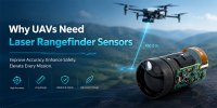
In this article, we'll explore why laser rangefinder sensors are becoming a standard component in professional UAV platforms and how they benefit various aerial applications.
What Is a Laser Rangefinder Sensor?
A laser rangefinder sensor measures the distance between the UAV and a target by transmitting laser pulses and calculating the return time or phase shift of the reflected signal.
Compared with ultrasonic or infrared sensors, laser rangefinders offer:
- Long measurement range
- High measurement accuracy
- Fast response time
- Excellent directionality
- Compact size and lightweight design
- Reliable operation outdoors
Modern laser rangefinder modules can measure from a few meters to several kilometers while maintaining meter-level or even centimeter-level accuracy depending on the measurement technology.
Why Accurate Distance Measurement Matters for UAVs
UAVs operate in constantly changing environments where precise distance information directly affects flight safety and mission quality.
Without accurate ranging, drones may experience:
- Incorrect altitude estimation
- Poor terrain following
- Collision risks
- Inaccurate mapping results
- Unstable autonomous flight
Laser rangefinder sensors provide real-time distance information that allows flight controllers to make continuous adjustments throughout the mission.
Key Benefits of Laser Rangefinder Sensors for UAVs
1. Precise Altitude Measurement
GPS altitude often contains errors ranging from several meters to even tens of meters depending on satellite conditions.A laser rangefinder directly measures the distance to the ground, providing much higher precision.
Benefits include:
- Stable low-altitude flight
- Accurate hovering
- Consistent inspection distance
- Improved landing precision
2. Terrain Following
Many UAV missions require maintaining a constant height above uneven terrain.Examples include:
- Agricultural spraying
- Forest monitoring
- Pipeline inspection
- Mountain mapping
Advantages include:
- Uniform spray coverage
- Better image resolution
- Safer low-altitude operations
- Reduced pilot workload
3. Obstacle Detection and Collision Prevention
Trees, utility poles, buildings, communication towers, and power lines present serious hazards during autonomous flight.Laser rangefinders provide accurate forward or downward distance measurements, allowing flight controllers to:
- Detect obstacles earlier
- Trigger avoidance maneuvers
- Maintain safe flight paths
- Reduce collision risks
4. Improved Precision Landing
Landing is one of the most critical phases of UAV operation.Wind, uneven terrain, and GPS drift can affect landing accuracy.
Laser rangefinder sensors help by providing:
- Accurate ground distance
- Smooth descent control
- Better touchdown accuracy
- Reduced landing impact
- Delivery drones
- VTOL UAVs
- Autonomous charging stations
- Maritime UAV operations
5. Better Surveying and Mapping Accuracy
Professional aerial mapping requires precise altitude information to ensure consistent image overlap and accurate 3D reconstruction.Laser rangefinder sensors improve:
- Digital elevation models (DEM)
- Orthophoto generation
- LiDAR-assisted mapping
- Volume calculations
- Construction site measurements
6. Enhanced Target Distance Measurement
Many UAVs are equipped with EO/IR cameras or thermal imaging systems.A laser rangefinder allows operators to determine the exact distance to an object, improving:
- Target localization
- Inspection reports
- Search and rescue operations
- Wildlife monitoring
- Border surveillance
Choosing the Right Laser Rangefinder for UAV Integration
Selecting a suitable laser rangefinder depends on the UAV's mission requirements.Important factors include:
Measurement Range
Choose a sensor that comfortably exceeds the maximum operating altitude or target distance.Typical options include:
- 100 m
- 300 m
- 700 m
- 1300 m
- 2000 m+
Weight
Every gram affects UAV endurance.Lightweight modules improve:
- Flight time
- Payload capacity
- Energy efficiency
Update Rate
Higher measurement frequency allows faster response during high-speed flight.Typical refresh rates include:
- 1–3 Hz
- 10 Hz
- 20 Hz
- Higher for specialized applications
Power Consumption
Low-power modules extend battery life and reduce thermal load.Interface Compatibility
Common communication interfaces include:
- UART
- TTL
- RS232
- RS485
- CAN
- I²C (for compact embedded systems)
Environmental Durability
Industrial UAVs often operate in demanding environments.Consider:
- Temperature range
- Vibration resistance
- Dust protection
- Moisture resistance
- Electromagnetic compatibility (EMC)
Conclusion
Laser rangefinder sensors have become a critical component in modern UAV systems. They provide accurate real-time distance measurements that improve flight stability, obstacle avoidance, terrain following, autonomous navigation, mapping accuracy, and precision landing.Whether the mission involves industrial inspection, agriculture, surveying, logistics, or defense, integrating a high-performance laser rangefinder significantly enhances operational efficiency and safety.
As UAV technology continues to advance, laser rangefinder sensors will remain a key enabler of reliable, intelligent, and high-precision autonomous flight.